
Our LHHT hike (You might want a tissue … )
The first half of trail
In August 2021, my husband, dogs (Toro and Faith) and I began our adventure on the Laurel Highlands Hiking Trail. We had completed the 250 mile Tuscarora Trail 4 days prior, took a short rest (i.e. went to our jobs) and then headed to Johnstown, PA. After the Tuscarora, the LHHT felt like a walk in the park (pun intended). Gentle slopes, well manicured paths, yellow blazes and stone trail markers: the 70 miles was the perfect break from rocky, thorn-infested, overgrown trails.
The summer weather was ideal for our kickoff weekend hike: not too hot and plenty of shade. The dogs and I were intrigued with the landscape, as the trail often wove between walls of rock. We periodically unleashed the pups and allowed them to run through the mazes, climb atop the boulders and scamper back through the rock-bordered trail. I’d venture to say that both Toro and Faith were smiling at the fun of that summer weekend.
Absent from our adventure was, Zinfandel, our newly rescued puppy girl, who was at home being spoiled by our youngest daughter. Zin was only 3 months old, and not old enough to join us on long hiking expeditions. Without the worry of puppy safety, we hiked as we always did, a 15+ mile Saturday and a short Sunday.
Toro, our 10 year old black lab, played like a puppy. Perhaps he was thrilled at the easy pathway or he was inspired by the energy of his puppy Zin. Faith, aged 7.5, enjoyed jumping atop the rocks to peer down at Toro who galloped through the maze. Watching them play together warmed my heart. It was clear that they were enjoying this trek as much as I had been. We returned the next weekend, completing another 20 mile weekend. We had only 30 miles to go for finish the trail.
Sadly, Toro would never return to the Laurel Highlands to finish the hike.

Heartbreak
During our time off trail, we had 2 tragedies on the same day. My niece’s husband lost his battle to pancreatic cancer. As my husband, daughter and I hugged and cried in the kitchen something strange caught my eye. I saw a flash of brown and one of black and then heard my daughter screaming, “Mom … Toro!!”
Toro collapsed to the floor with a seizure. Puppy Zin ran away (the black flash). Faith (the brown flash), ran toward Toro, placed her paws on his chest and held his face with her teeth. She was trying to care for the seizing “black bear”. The emergency vet service said to keep Toro at home unless another seizure occurred. Unfortunately, as I hung up the phone, another one hit and it was worse than the first one. We carried him to the Suburban and left a crying daughter and a howling Faith behind.
Our poor boy had more seizures in the waiting room and even more after we left him in the vet’s care at 3 am.
Toro’s diagnosis: a brain tumor. Over the next 3 days, I took him to 2 additional veterinarians. The news was always the same. How? How could this possibly be true? Only 3 months prior, during his annual check-up, he received a “clean bill of health” and followed the great news with several hundred miles of hiking.
After 2 weeks of medication, loads of cuddles, and many tears, we helped Toro peacefully hike across the rainbow bridge. He lay on his favorite bed in our home, surrounded by his human family, Faith and Zin.

Back on the trail
I could not possibly return to the Laurel Highlands trail without Toro, and therefore, I did not. Instead, we began a new distance project with Faith and hiked locally with Zin, teaching her trail manners.
On Monday, August 8, 2022, I had this crazy urge to finish the LHHT, however, we had upcoming weekend plans to hike in Shenandoah National Park. After a quick weather check, we canceled our hotel in Front Royal, VA and booked a new one in Somerset, PA. We filled our packs, gathered dog supplies and drove 3 hours in 2 separate vehicles. On Friday morning, Zin stepped onto the LHHT for the first time. We split the final 30 miles into 3 days, cautious not to overwork Zin, who was only 14 months. She romped with Faith in the small water sources and, together, they raced through the rock mazes.
On August 14, 2023, exactly one year after Toro exited the trail, Zin, Faith, Brian and I completed the Laurel Highlands Hiking Trail in his honor. To my great surprise, I was not overwhelmed by sadness; rather, I felt joy. I spent the miles remembering Toro, our joint adventures, his snuggles, snores, antics and his unfailing loyalty. As I walked with my girls, Faith and Zin, I felt a resurgence of excitement for great adventures to come. Toro passed the baton to Zin and she picked it up and ran with it!


My flesh and my heart fail: but God is the strength of my heart and my portion forever.”
Psalms 73:26


The Laurel Highlands Hiking Trail details
The 70 mile Laurel Highlands Hiking Trail is located in southwestern Pennsylvania, connecting the Laurel Ridge State Park, in Seward (near Johnstown), and the Ohiopyle State Park, Ohiopyle, PA. The LHHT is extremely well maintained by the PA DCNR. In fact, we saw several park rangers and staff members on our walks, patrolling the parking areas and checking on the trail. Yellow blazes and stone pillar mile markers designate the pathway. The parking areas are large, host trash receptacles, signage and trail registry. There was virtually no trash on the trail, just an occasional granola bar corner piece that probably fell out of an unsuspecting hiker’s pocket. We were very impressed with our hiking experience on this trail.
Eight shelters areas are located along the trail with each area hosting 5 shelters, space for 25 tents, vault toilets and a non-potable water source. Camp registration is required and can be made via phone at 724-455-3744 or online at www.visitPAparks.com.
Download my LHHT map on AllTrails. The map includes parking areas, shelter locations and photos from our hike. Click here to access it or click the map photo below.

| Hike difficulty classifications (link) | |
|---|---|
| Route type | Point to point. |
| Trail difficulty level | Moderate to strenuous due to the mileage and elevation gain. Trail is well marked and maintained. |
| Geographic location | Western Pennsylvania |
| Trailhead parking options | PA Route 56 parking lot, Seward, PA (or PA Route 381 parking lot, Ohiopyle, PA, if walking northbound |
| Trail amenities | Shelters and vault toilets at miles: 5.1, 13.1, 23.5, 37.5, 46, 51.5, and 63.7 |
| Elevation - trailhead | 1,304' |
| Elevation - highest peak | 2,982' |
| Elevation gain | 10,276' |
| Total mileage | 70 miles |
| Water sources | Trailhead, shelter areas, Seven Springs Ski resort, small streams and lakes. Non potable water, use a filter. |
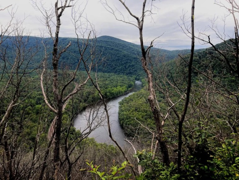
| Highlights | Rock mazes, Beam Rocks (mile 29), views of the Youghiogheny River |

Additional resources
Print maps are available at the trailheads. Click here for the pdf version.
Available for purchase:
- Trail guide from the Sierra Club Pennsylvania, Allegheny Chapter
- Detailed Purple Lizard waterproof map from the Keystone Trails Association
- Laurel Highlands Hiking Trail completion patch from the Keystone Trails Association

Website resources:
- Pennsylvania DCNR – Shelter permits, wildlife and other details
- National Park Service – End to end details
- Go Laurel Highlands – LHHT and other trails and recreation opportunities in the area
