
Trekking over Mt Rogers and through the Grayson Highlands was one of my favorite hikes of the year. I had been looking forward to this stretch of the Appalachian Trail for several weeks, expecting to see beautiful views and hoping to see some of the 100 wild ponies that roam the region. The hike was far better than I had anticipated! We walked 43 miles, 39 of those on the AT. The trail led us into the Lewis Fork Wilderness, Grayson Highlands State Park, Mount Rogers National Recreation Area and the Jefferson National Forest.
Mt. Rogers is the highest peak in Virginia (5,729′), thus the AT leading to and from its summit has gorgeous views. Within Grayson Highlands, we trekked over many grassy balds, tree-free summits covered in native grasses. The balds provide amazing views of the surrounding valleys and mountain ranges.
Northbound: Mile 494.3 to 533.7; 39.4 miles
Elk Garden (Whitetop Mountain Road) to Fairwood Road (Rt 603); 17.4 miles, 2,513′ elevation


We began our hike at the Elk Garden Trail head on Whitetop Mountain Road. It was the first chilly day of the fall, 35 degrees and windy. Our starting point was 4,449′ in elevation, and we hit our first beautiful view only .3 miles later.

The trail entered woodlands and we walked on the familiar trail of leaves, small rocks and rain puddles for 3 miles, reaching our second meadow view at 5,225′. We returned to the forest trail for approximately 1 mile, and at the Mt Rogers summit trailhead, the trees began to disappear and the landscape changed to vast balds. From the Mt Rogers trailhead to the Scales campground, there is approximately 8 miles of views. It was incredibly beautiful and my husband and I both kept taking photos and making exclamations in awe.


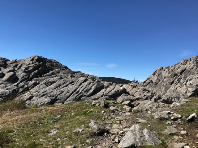

Just a half mile north of these rocks, we were greeted with our first views of wild ponies. I could have stood there forever, listening to the ponies whinny and the wind howl. The backdrop of mountains made the experience perfect. We still had 11 miles to hike, and therefore we forced ourselves to move forward. Fortunately, more than 6 of those miles included summit meadow views and ponies along the trail.

At mile 501.5, a short .6 mile side trail connects from the Massie Gap parking area to the AT. For those not interested in hiking a long distance to see the ponies and views, this is a great alternative. As we continued north past the Gap, ponies dotted the highlands along the trail and some even blocked our pathway.


After walking through the Scales campground that was once an old corral used for cattle trade, we returned to a wooded trail, ending our hike on Route 670, Teas Road.
Map – Elk Garden to Fairwood Road
Learn more:
Mt Rogers National Recreation Area
Fairwood Road to Teas Road; 14.3 miles, 2,530′ elevation

Our hike north from Fairwood Road was almost entirely in the woods, with only one meadow section around the 13 mile mark (NoBo 524.6). We had 1 significant hill climb, about a thousand foot increase over the first 2 miles. For the remainder of the trek, we had gradual ups and downs.
We enjoyed walking through rhododendron groves near various streams along the path. Water seemed to be the theme of this hike. We began our walk by crossing the footbridge over Fox Creek. The water was flowing pretty quickly due to the furious rain storms earlier in the week.

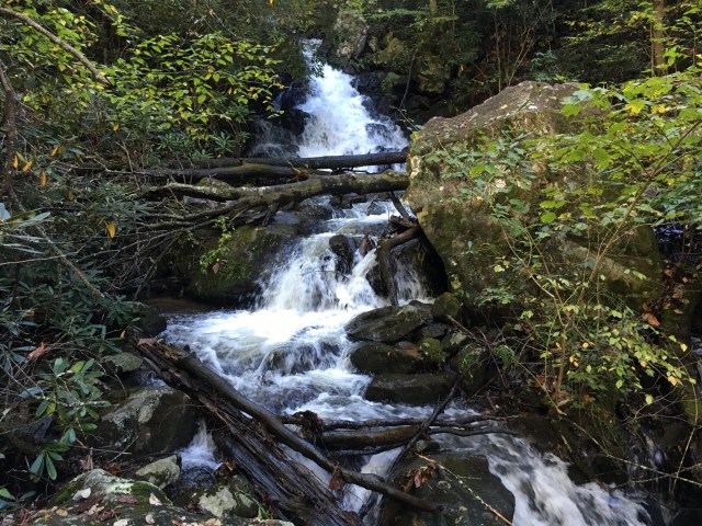
Thanks to Hurricane Michael, there were water falls and streams that frequently intersected or flowed onto the trail.
The highlight of this wooded hike was Comers Creek Falls, a water fall located at NoBo mile 518.3, about the halfway point of our hike.
As we neared our final destination at Teas Road, we crossed a pretty meadow and then a sturdy bridge over a branch of the Holston River.


Map – Fairwood Road to Teas Rd
Teas Road to Mt Rogers Headquarters; 8.4 miles, 1,673′ elevation
The day was cold with steady rain for most of the hike. We began on Teas Road, mile 525.8, elevation 2,446′, and walked a very gradual incline of 1,000′ over 4 miles. The section was very typical for a wooded hike: little ups and downs, with rocky patches and lots of fallen leaves.

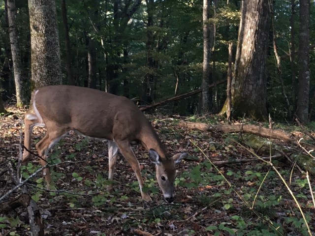
While walking ahead of my husband and the dogs, I came face to face with a lovely deer. She lifted her head, took a few steps closer to me, and then resumed grazing. I paused and watched her until the noise of my dogs’ running feet caused her to flee through the trees.
Just before we reached the Mt Rogers Headquarters, our end point, we stopped at the Partnership Shelter. We’ve stayed in many shelters, but never one with running water, therefore I was very impressed that this one had a shower, a sink and room for 16 people. An extra bonus, the headquarters, only .2 mile further, has “real” toilets.